


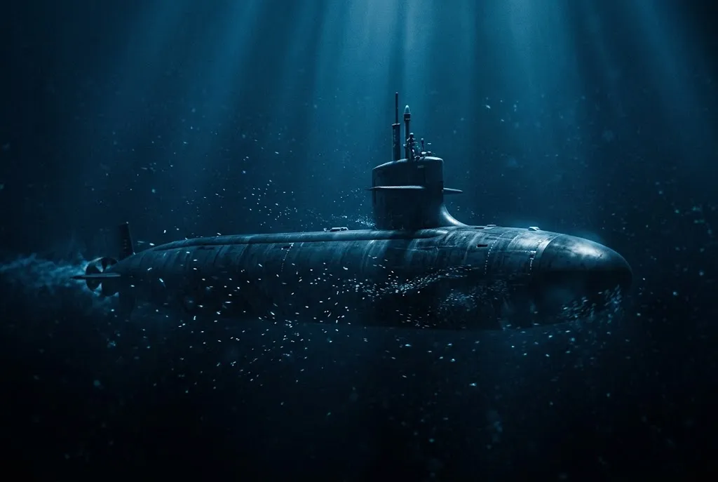
Blind at 800 Feet Below the Waves
I used to assume that modern submarines navigated the deep sea pretty much the same way our phones guide us through an unfamiliar city. Surely, I thought, an antenna on the sail just caught satellite signals through the water, or an onboard autopilot pinged the surrounding sea like an underwater radar screen.
Not quite.
Down at operational depths, a submarine is utterly blind to the sky. Hundreds of feet of saltwater block every satellite signal we rely on above the surface. If you turn on an active sonar ping to see what lies ahead, you announce your exact coordinates to every hydrophone within fifty miles.
Yet these massive vessels slip beneath the waves in Scotland or Washington state, run silent for three straight months, and surface halfway across the planet within a few meters of their intended point. While modern crews can generate unlimited oxygen underwater to remain submerged indefinitely, surviving is only half the battle. If you do not know where you are, a multi-billion-dollar submarine is just a blind steel tube heading toward an undersea mountain.
How do you steer through pitch-black water when you cannot see, cannot broadcast, and cannot call home?
Why GPS Fails in Saltwater
On dry land, navigation feels effortless. Our handheld devices count on satellite constellations to pinpoint our exact location by timing radio pulses that travel across empty space at the speed of light. Those signals operate at ultra-high frequencies, mostly around 1.2 to 1.5 gigahertz.
Seawater kills those radio signals instantly.
Water is an electrical conductor. Because ocean water is packed with dissolved sodium and chlorine ions, it acts like a massive electromagnetic shield. High-frequency radio waves induce tiny electrical currents in the water, which rapidly converts the radio energy into heat.
Physicists call this the skin depth effect. By the time a standard GPS radio signal penetrates just two or three inches beneath the surface, it has decayed into undetectable static. A submarine commander at patrol depth receives nothing.
Radio Band / Source      Penetration Depth in Saltwater
----------------------------------------------------
GPS (1.575 GHz)          ~2 to 3 inches (5–8 cm)
Standard HF Radio        ~1 foot (30 cm)
VLF Naval Radio          ~30 to 60 feet (10–20 meters)
ELF Transmissions        ~300+ feet (100+ meters)
To navigate, a submerged crew must turn inward. Instead of asking the universe where they are, they calculate where they must be based entirely on how they moved since the second they submerged.
The Science of Inertial Navigation: Counting Every Inch
The foundation of submarine travel is an advanced form of dead reckoning executed by an onboard system of staggering complexity: the inertial navigation system (INS).
Inertial navigation systems (opens in a new tab) operate on Isaac Newton’s first law of motion. If you know your exact starting position at the pier, and you continuously measure every single acceleration, pitch, roll, and turn your ship makes, you can calculate your new position mathematically.
Three precision accelerometers sit at right angles inside the unit to measure movement forward, sideways, and vertically. When the ship speeds up, a microscopic suspended mass inside each sensor resists that movement. The system measures that resistance as specific force.
Then comes the calculus. Integrate acceleration once over time, and you get velocity. Integrate velocity a second time, and you get distance traveled.
It sounds clean on paper. In practice, it is an engineering nightmare.
Trapping Light in a Triangle: The Ring Laser Gyroscope
Accelerometers only report straight-line shoves. If you do not know the exact angle of those shoves in 3D space, your calculations fall apart within minutes.
Old submarines solved this with heavy mechanical gyroscopes—brass wheels spinning at tens of thousands of revolutions per minute mounted inside gimbals. But mechanical bearings wear down. Friction creeps in. Tiny vibrations wobble the spin axis.
Modern nuclear submarines ditched spinning wheels for trapped beams of light. They use ring laser gyroscopes (RLGs).
Inside an RLG, technicians bore a triangular or square path through a solid block of Zerodur—a glass-ceramic material engineered to have virtually zero thermal expansion across extreme temperature swings (and honestly, the first time I saw the manufacturing specs for one of these optical blocks, I had to double-check the decimal points).
Two helium-neon laser beams travel inside this cavity along the exact same optical loop, but in opposite directions. One beam circulates clockwise; the other circulates counterclockwise.
This setup leverages the Sagnac effect (opens in a new tab), first demonstrated by French physicist Georges Sagnac in 1913. When the submarine turns, the gyroscope turns with it.
Because the sensor rotates while the light is moving, the laser beam traveling in the direction of the turn has to cover a fractionally longer path to finish the loop. Meanwhile, the beam traveling opposite the rotation covers a slightly shorter path.
When those two counter-rotating light waves meet at an output mirror, their wavefronts interfere. They produce light and dark fringes that slide past an optical detector. By measuring the frequency shift between the two beams, the navigation computer measures turns down to fractions of a thousandth of a degree per hour.
No friction. No bearings. Pure optical geometry.
The 84-Minute Pendulum and the Drift Problem
Even with ring lasers, inertial navigation faces a relentless enemy: mathematical integration drift.
Because the computer multiplies acceleration across seconds, minutes, and weeks, tiny errors compound exponentially. If an accelerometer is miscalibrated by a micro-g—a phantom force so small a grain of salt would trigger it—that error squares over time. Within days, the computer thinks the submarine is miles away from its actual position.
Drift is ruthless.
This is why the blue dot on your phone map suddenly starts drifting down side streets when you enter a long road tunnel: without active radio signals, standard motion sensors quickly accumulate drift.
To make matters stranger, Earth is not flat. If a submarine travels straight ahead without accounting for our planet’s curvature, its gyroscopes would soon claim the ship was climbing into space.
To correct this, marine inertial systems incorporate Schuler tuning. In 1923, German engineer Maximilian Schuler proved that a pendulum with an effective period of 84.4 minutes—the time it would take a hypothetical satellite to orbit Earth at sea level—remains naturally aligned to the local vertical, regardless of how its base accelerates.
By programming this exact 84.4-minute resonant frequency into the guidance algorithms, engineers prevent the system from confusing the submarine’s forward travel with Earth’s curvature.
Yet even the best Schuler-tuned ring laser system drifts by roughly half a nautical mile to a mile per day. After two weeks underwater, that error could run an eighty-man crew straight into a continental shelf.
Submarines need an external reality check. But how do you check your position without surfacing?
Reading the Ocean Floor Without Making a Sound
The first correction tool is a device mounted directly to the submarine’s belly: the Doppler Velocity Log (DVL).
A DVL emits four narrow, high-frequency acoustic beams aimed downward at the seabed in an X-shaped pattern. By listening to the pitch shift of the acoustic echoes bouncing off the ocean floor, the DVL measures the boat’s speed over the actual ground, rather than its speed through moving currents.
Because the acoustic beams point straight down at low power, enemy listening posts cannot detect them from a distance. Feeding true ground speed directly into the inertial computer stops velocity drift in its tracks.
Still, measuring speed does not tell you your absolute starting coordinate. If your map was off by two miles yesterday, knowing your exact speed today only preserves that two-mile mistake.
This is where modern naval engineering crosses into science fiction: navigating by Earth’s invisible gravitational landscape.
The Ghostly Pull of Underwater Mountains: Gravity Gradiometry
Earth’s gravity is not uniform. Dense volcanic basalt pulls harder than porous sediment. An underwater mountain ridge exerts a tiny bit more gravitational acceleration than an empty oceanic trench.
To exploit this, modern ballistic missile submarines carry gravity gradiometry (opens in a new tab) systems—a technology originally developed by Bell Aerospace and kept classified for decades.
A gravity gradiometer does not just measure raw gravity; it measures the spatial rate of change of gravity across multiple axes using pairs of ultra-sensitive accelerometers mounted on a rotating carousel. As the submarine glides over an underwater canyon or iron-rich seamount, the gradiometer detects variations as small as a fraction of an Eötvös unit (one part in ten billion of Earth’s surface gravity).
The submarine’s computer compares those gravitational fingerprints against high-resolution bathymetric and gravitational maps stored in its memory banks.
If the sensors detect a specific gravitational gradient pattern matching a known ridge off the coast of Greenland, the navigation computer recognizes the terrain instantly. It resets its position fix without broadcasting a single signal, without surfacing, and without alerting a soul.
When gravity maps are not enough, subs can also deploy a floating wire antenna. Trailing thousands of feet behind the vessel just beneath the waves, this wire catches Extremely Low Frequency (ELF) and Very Low Frequency (VLF) radio broadcasts transmitted by naval mega-antennas stationed thousands of miles away. These long waves penetrate the upper layers of the ocean, delivering encrypted positioning updates straight to the deep.
Navigating in the Pitch-Black Ocean
When you look at a submarine from the outside, you see brute mechanical force—thousands of tons of high-yield steel driven by nuclear steam.
Inside, survival depends on an entirely different world of physics. Submarine crews do not navigate by overpowering the ocean with blinding searchlights or deafening sonar blasts. They survive by reading the subtlest whispers of the universe: the interference fringes of trapped laser light, the Doppler shifts of echoes off the silt, and the microscopic gravitational pull of hidden mountain peaks thousands of feet below.
It is silent, invisible, and completely self-contained. In an era where every gadget on Earth screams for an internet connection, submarines prove that with enough physics, you can cross an ocean completely on your own.





Conversation0
No comments yet. Be the first to share a thought — the best questions often become new stories.