### The Enigmatic Canvas of the Peruvian Desert
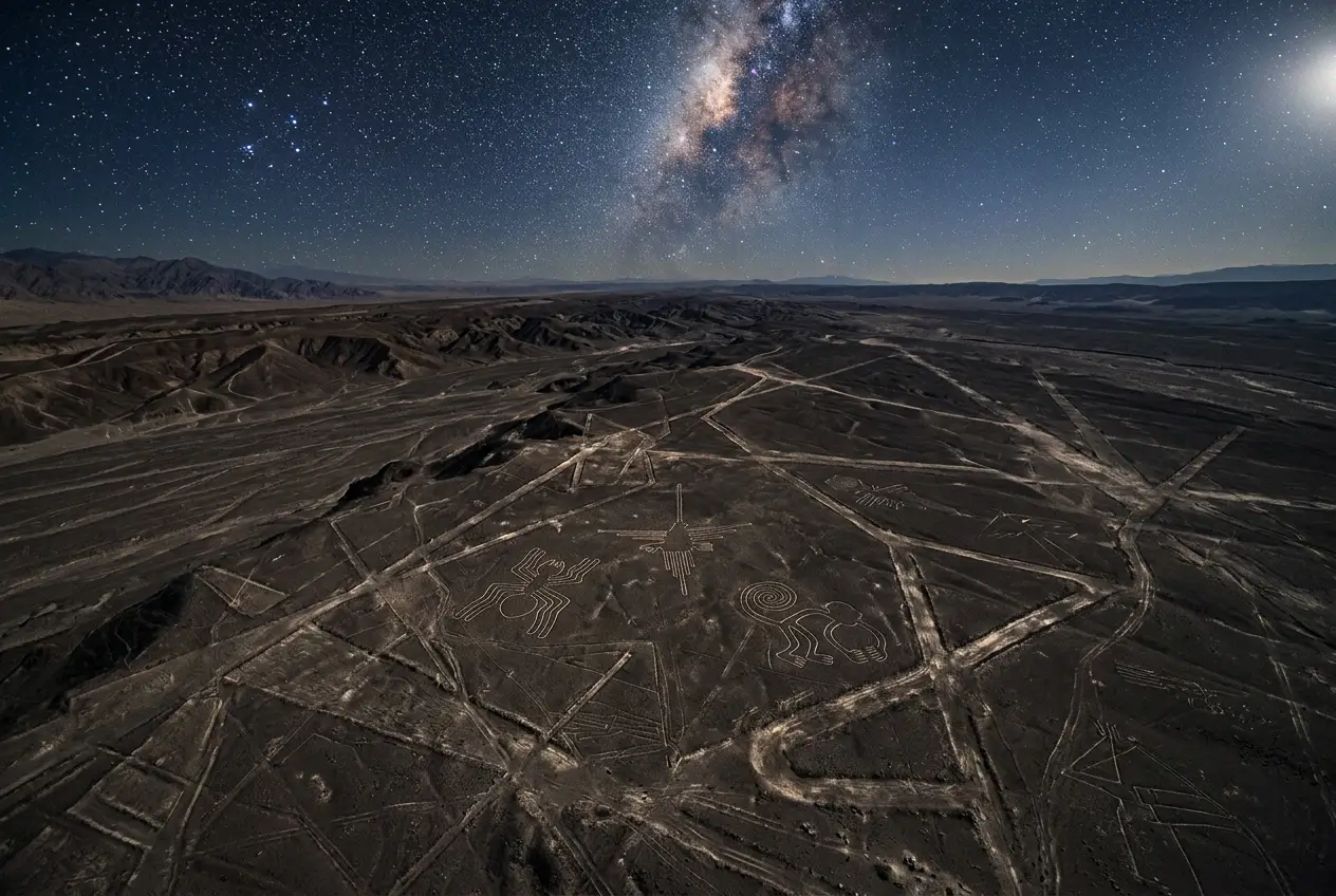
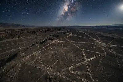
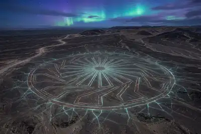
I remember the first time I saw aerial photographs of the Nazca Lines. It wasn't just the sheer scale that captivated me, nor the striking precision of the figures etched into the Peruvian desert floor. What truly sparked my imagination was the nagging question: *why?* Why would an ancient civilization dedicate such monumental effort to create drawings visible only from high above? For decades, these geoglyphs have been an enduring archaeological enigma, often interpreted as ritualistic art, astronomical calendars, or even landing strips for extraterrestrials. But recently, I've been diving into a more radical, yet scientifically grounded, theory: **Could the Nazca Lines have served as a sophisticated cosmic calibration grid, a vast ancient instrument for understanding our place in the universe?**
Imagine a colossal chalkboard stretching over 450 square kilometers, where ancient engineers meticulously plotted not just animals and geometric shapes, but perhaps a complex system designed to track celestial movements, measure vast distances, or even map unseen energies. This isn't just a flight of fancy; it’s a perspective gaining traction among a fringe of researchers who believe we might be underestimating the scientific prowess of the Nazca people.
### Beyond Art: The Whisper of Ancient Engineering
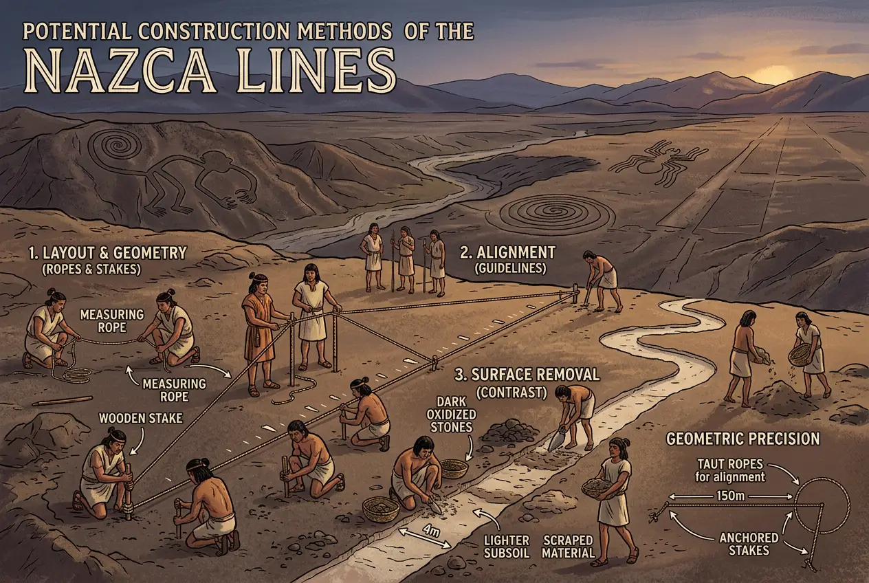
The Nazca Lines, attributed to the Nazca culture which flourished from roughly 100 BCE to 800 CE, are more than just impressive drawings. They represent an astounding feat of engineering and observation. The process involved removing the reddish-brown iron-oxide-coated pebbles from the desert surface to expose the lighter, yellowish-grey subsoil. The arid, windless conditions of the Nazca Pampa have preserved these lines for centuries. But the methodology itself suggests a level of planning and coordination that points to a society with significant organizational and perhaps scientific capabilities.
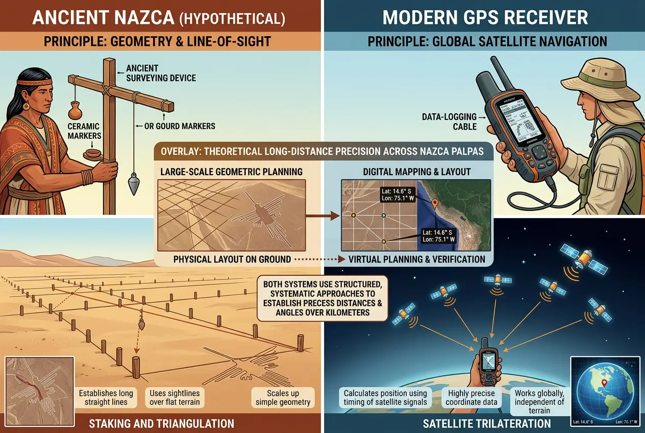
How did they achieve such immense scale and accuracy without the benefit of aerial perspective? Theories range from simple rope-and-stake methods for circles and straight lines, possibly guided by observation platforms on nearby hills, to more complex systems of scaled models or even balloon flight – though the latter is largely speculative. What is undeniable is the astonishing geometric precision. Some lines run perfectly straight for kilometers, deviating by mere meters. This precision is what makes the "cosmic calibration" theory so compelling.
### Alignments and Astronomical Hypotheses
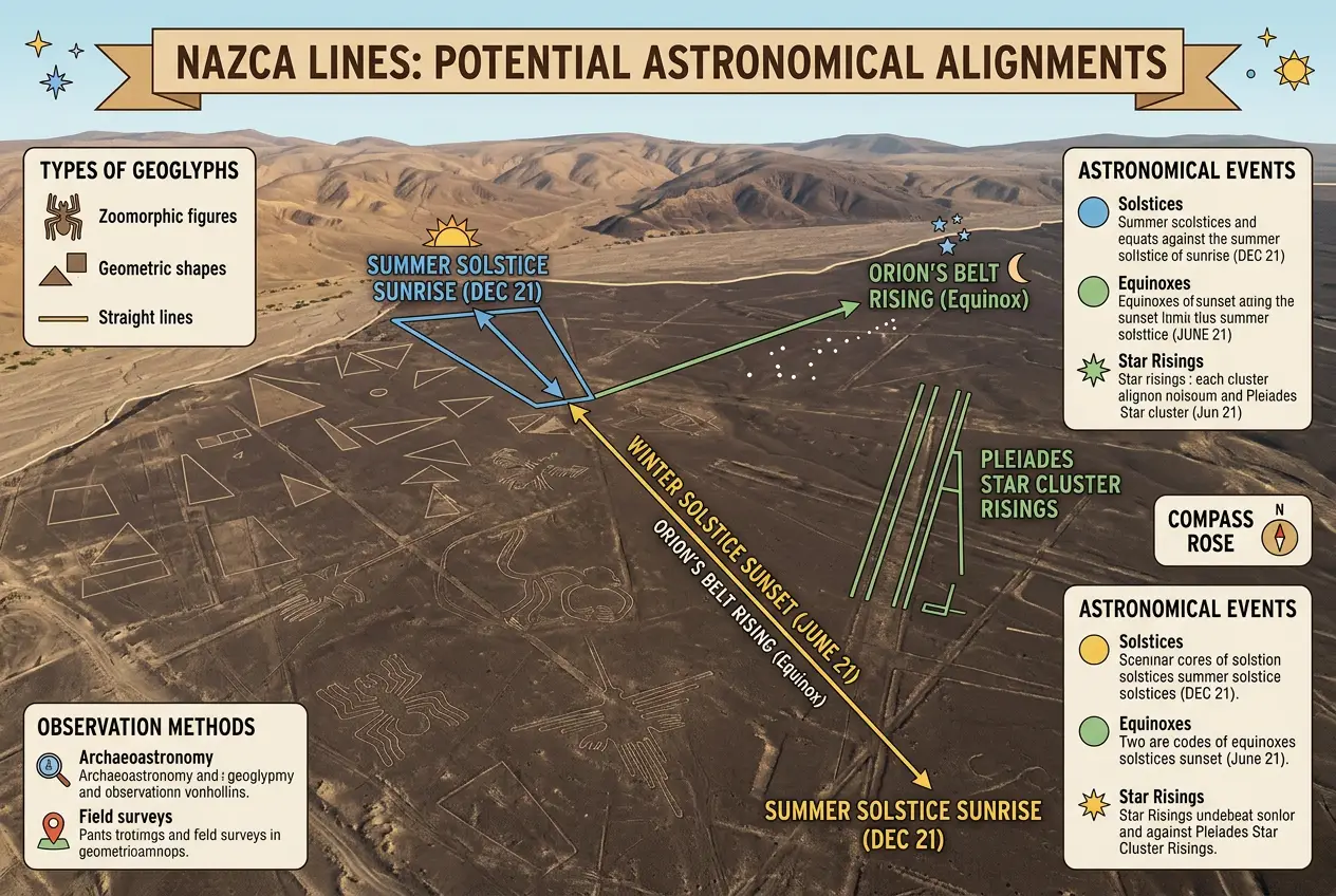
One of the most persistent theories surrounding the Nazca Lines is their astronomical significance. Many researchers, including the pioneering work of Maria Reiche, who dedicated over 40 years to studying and preserving the lines, believed they functioned as a giant astronomical calendar. Reiche suggested that various lines and figures align with significant celestial events like solstices, equinoxes, and the rising and setting of certain stars. If so, they weren't just observing; they were *calculating* and *recording* these observations on a monumental scale.
While specific alignments can be debated due to the sheer number of lines, the concept itself hints at a culture deeply attuned to the cosmos. I’ve often wondered if these alignments weren’t just for tracking time, but for something more profound. What if these intricate patterns were part of a larger system, a framework for understanding planetary cycles, or even a precursor to what we now call a celestial coordinate system?
Consider the immense straight lines that traverse the pampa. Some researchers propose these lines might have served as pointers to water sources, pilgrimage routes, or clan boundaries. However, their sheer number and seemingly arbitrary directions for such purposes leave me feeling there's more to uncover. Could they be vector lines, indicating directions to specific celestial bodies at specific times, or even marking the precise moments of rare astronomical phenomena? For more on how ancient cultures observed the skies, you might find this article on [mapping invisible skies]() fascinating.
### The "Cosmic Grid" Hypothesis: A Leap in Understanding?
The idea of the Nazca Lines as a "cosmic calibration grid" pushes beyond simple astronomical observation. It suggests a more active, instrumental role. This theory proposes that the lines, particularly the geometric shapes and intersections, formed a giant land-based instrument for precise measurement or calculation.
**What would a cosmic calibration grid entail?**
1. **Observational Precision:** Imagine using the intersections of lines as precise sightlines for observing the rising or setting of stars, planets, or even distant celestial phenomena. The sheer length of some lines would allow for incredibly accurate angular measurements.
2. **Geodetic Survey:** Could the Nazca people have been conducting an ancient geodetic survey of their landscape, perhaps linking terrestrial features to celestial positions? This would require an understanding of spherical geometry and advanced surveying techniques.
3. **Energetic Mapping:** A more speculative, but intriguing, idea is that the lines somehow interacted with natural earth energies or magnetic fields. Some ancient structures are theorized to resonate with Earth’s frequencies, as explored in articles like [did ancient structures resonate with Earth’s frequencies](). Could the Nazca Lines be an amplified version, designed to mark points of energetic significance or even create a resonant field?
4. **Instructional Diagrams:** Perhaps the entire complex was a giant instructional diagram, not unlike a cosmic blueprint, encoding knowledge about the universe or even a system for future generations to "read" the heavens. The idea of encoding complex data into physical forms is not new; consider how [ancients coded planets into stone]().
### The Evidence and the Debate
While the "cosmic calibration grid" theory sounds dramatic, what evidence supports it beyond visual awe? The most compelling aspects are the precision and redundancy of the lines. Why so many? If it were purely symbolic, fewer lines might suffice. The intricate layering and overlapping of lines over centuries suggest continuous use and adaptation, as if the "instrument" was being refined or recalibrated.
Dr. Phyllis Pitluga, an astronomer from the Adler Planetarium, proposed that the Nazca figures, particularly certain zoomorphic designs, might represent star patterns or constellations, not just as art, but as a mnemonic device for navigating the sky. Her work suggests a connection to the movements of the Pleiades and other star clusters.
However, the scientific community largely remains cautious. Attributing such advanced scientific understanding requires more than just observed correlations. It demands concrete evidence of the tools, mathematical knowledge, and societal structure capable of conceiving and executing such a grand "computer." Critics often point out that many alignments can be found by chance in such a vast network of lines. It’s the difference between finding patterns and proving intent.
Despite the skepticism, the debate itself forces us to re-evaluate our perceptions of ancient civilizations. Were they merely superstitious farmers, or did they possess a sophisticated, albeit different, form of scientific inquiry? As John Anthony West, the independent Egyptologist, once said, "There is no more certain test of the scientific status of a hypothesis than its predictive power." For the Nazca Lines, their "predictive power" remains locked in the past, awaiting our deciphering.
### The Challenges of Deciphering an Ancient Blueprint
Deciphering the true purpose of the Nazca Lines is akin to trying to read a blueprint without the legend. We are looking at the output, but lack the input parameters and the processing logic. The challenges are immense:
* **Lack of Written Records:** The Nazca left no written language that we have discovered, making it difficult to understand their worldview and scientific lexicon.
* **Destruction and Erosion:** Despite the arid climate, some lines have suffered from natural erosion and modern human activity, obscuring parts of the original design.
* **Modern Bias:** We tend to interpret ancient phenomena through a modern lens, often projecting our own scientific frameworks onto cultures that may have had entirely different ways of understanding the cosmos.
Nevertheless, modern technologies, such as drone mapping, satellite imagery, and advanced astronomical software, are opening new avenues for research. These tools allow us to analyze the lines with unprecedented accuracy, identify subtle patterns, and test hypotheses against vast datasets of celestial movements.
### A Legacy of Wonder
Whether the Nazca Lines were a sacred calendar, an alien beacon, or a cosmic calibration grid, their existence is a testament to the ingenuity and enduring curiosity of ancient humanity. They force us to confront the possibility that complex scientific and engineering knowledge may have existed in forms we are only beginning to comprehend.
As I look at the Nazca Lines, I don't just see ancient art; I see a question etched into the earth itself. A question that invites us to look deeper, to challenge our assumptions, and to continue the endless quest for knowledge about our past and our universe. Perhaps the greatest lesson the Nazca Lines offer is that the universe has always been an open book, and ancient cultures, in their own unique ways, were trying to read its profound chapters, much like we are today.
**References:**
* [Nazca Lines - Wikipedia](https://en.wikipedia.org/wiki/Nazca_Lines)
* [Maria Reiche - Wikipedia](https://en.wikipedia.org/wiki/Maria_Reiche)
* [Archaeoastronomy - Wikipedia](https://en.wikipedia.org/wiki/Archaeoastronomy)
* [Pleiades - Wikipedia](https://en.wikipedia.org/wiki/Pleiades)
Frequently Asked Questions
The Nazca Lines are a series of ancient geoglyphs—massive designs or motifs—etched into the desert floor of the Nazca Desert in southern Peru by the Nazca culture (100 BCE–800 CE). They depict various animals, plants, geometric shapes, and straight lines.
The Nazca people created the lines by removing the reddish-brown iron-oxide-coated pebbles and rocks from the desert surface, exposing the lighter, yellowish-grey subsoil beneath. The arid climate has helped preserve them for centuries. The precision suggests advanced surveying and engineering techniques, possibly using ropes and stakes.
The most widely accepted theories suggest the Nazca Lines had ritualistic or astronomical purposes, acting as a giant calendar to track solstices, equinoxes, and other celestial events, or as part of water cults. Some also believe they marked pilgrimage routes or clan territories.
This theory, though more speculative, proposes that the Nazca Lines were not just observational tools but a complex, land-based instrument for precise measurement, calculation, or even mapping of celestial bodies and terrestrial features. It suggests a more advanced scientific function than previously acknowledged.
Several factors contribute to the mystery, including the absence of written records from the Nazca culture, the vast scale and complexity of the designs, and the challenges of interpreting ancient cultural practices through a modern lens. While modern technology aids analysis, definitive proof remains elusive.
Verified Expert
Alex Rivers
A professional researcher since age twelve, I delve into mysteries and ignite curiosity by presenting an array of compelling possibilities. I will heighten your curiosity, but by the end, you will possess profound knowledge.
Leave a Reply
Comments (0)
No approved comments yet. Be the first to share your thoughts!
 Join Us
 Alex Rivers


Leave a Reply
Comments (0)